

Spring Creek Trail
City of Garland

The first 0.8-mile phase of what will become an almost five-mile trail that connects various neighborhoods, the County's Spring Creek Forest Preserve and Spring Creek Park Preserve, the City's Winters Park, Hawaiian Falls, and the Curtis Culwell GISD Special Events Center has recently been completed.
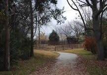
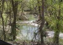
This first phase is located between Holford Road and North Garland Avenue. It provides a scenic tour through the County's Spring Creek Forest Preserve which possesses some of the oldest trees in Dallas County. The preserve also offers visitors paved parking, restroom facilities, and a picnic pavillon.
The design for the trail's second phase, which will extend the trail to the east by another 2.2 miles so that it will connect with Winters Park, Hawaiian Falls, and the Culwell Center, is presently underway and should be completed in 2014. Once this component is completed, the City will seek to bid this phase's construction.
Discussions for a third phase are also underway. This third phase would extend the trail to the west so that it would connect with the Spring Creek Park Preserve and the City's existing 0.8-mile trail that is located at Shiloh and Campbell Road.
 |  |  |
-
You must be on the network to see these links.
© 2024. Dallas County. All rights reserved.