

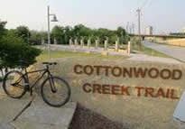
Cottonwood Trail
City of Dallas
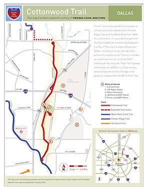
Funded by TxDOT, Dallas County, the City of Dallas, and a variety of private sources, the 3.1-mile Cottonwood Trail provides a critical connection between the Preston Ridge Trail and the White Rock Trail. With this connection, it is possible to travel from the City of Dallas' far northern boundary with the City of Plano to the edge of downtown Dallas--a distance of over 20 miles--without the need of a car.
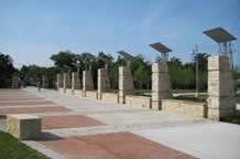
The trail, which directly links with a DART light rail station, also includes an impressive section built by TxDOT underneath the massive "High Five" highway interchange at I-635/Central Expressway and a handsome series of bridges and plazas as it approaches the White Rock Trail.
 |  |  |
-
You must be on the network to see these links.
© 2026. Dallas County. All rights reserved.